Entering route stop-off points
You can enter addresses, coordinates or motorway junctions and add them as a stop-off point. It is also possible to search for terms in different address types. This means, for example, that you can find the Charles de Gaulle airport in Paris, even though you may not know the exact postal address.
Tips: The columns in the list of stop-off points can be customised. More information can be found in the article Customising lists.
You can change the name of the stop-off point list directly in the tab by double clicking on  .
.
Entering addresses
-
Select the desired country from the list if necessary.
Tip: A preset country is best if you are only performing national transports. This makes the search for addresses quicker.
-
In the entry field Addresses enter the postal data of the stop-off point.
Note: Comply with the sequence postcode town, street house number and always separate the street with a comma!
While entering the details, a list of suggested locations opens.
Tip: In the settings you can specify that the address search should only begin once Return has been clicked (see Address search settings).
-
Insert the required location with a double-click.
The location is inserted in the list of stop-off points.
@ enter coordinates
Coordinates can be entered in TLNplanner internet or inserted using copy&paste and included in the list of stop-off points.
The entry of coordinates is introduced with the @ sign in the Address entry field followed by the coordinates (latitude and longitude).
Note: Important: Use a decimal point when entering coordinates, not a comma. The comma is interpreted as a separator.
Examples:
-
WGS 84 (DDD° MM' SS.S")
Reference system is WGS 84 (World Geodetic System).
The coordinates are entered in the format degrees, minutes, seconds,
e.g. Haid-und-Neu-Straße 15, 76131 Karlsruhe
Latitude 49.01334° (N) Longitude 8.4278° (E)
Input: @49°0'48.024'', 8°25'40.08''
-
WGS 84 decimal (DD.DDDDD)
Reference system is WGS 84 (World Geodetic System).
The coordinates are specified in decimal degrees,
e.g. Haid-und-Neu-Straße 15, 76131 Karlsruhe
Latitude 49.01334° (N) Longitude 8.4278° (O)
Entry:@49.01334, 8.4278
-
Degrees/minutes
Reference system is WGS 84 (World Geodetic System).
The coordinates are entered in degrees and minutes,
e.g. Haid-und-Neu-Straße 15, 76131 Karlsruhe
Latitude 49.01334° (N) Longitude 8.4278° (E)
Input: @49°0.800400', 8°25.668000'
-
PTV Mercator
Note: The Mercator format is an internal coordinate format which you can use to replace geographical data in PTV products. If, for example, you export a database, you can export the PTV coordinates along with it.
e.g. Haid-und-Neu-Straße 15, 76131 Karlsruhe
Latitude 49.01334° (N) Longitude 8.4278° (E)
Input: @937140, 6270074
Tip: TLNplanner internet recognises still more coordinate formats. If you wish to use a coordinate format that has not been specified, just try it.
-
Enter your chosen coordinates, for example @48° 56' 18.5', 8° 25' 53.8".
TLNplanner internet shows the location which matches the coordinates.
-
Insert the location with a double-click.
The location which matches the coordinates is inserted in the list of stop-off points.
# Entering toll points and junctions
If you wish to enter toll points or junctions as stop-off points, start the entry with the character # in the entry field Address. Then enter the required junction.
Examples
-
#A5 finds all junctions which contain the character string A5.
-
#A5 (26 finds all junctions with the number 26 that contain the character string A5.
-
#A5 (2 finds all junctions starting with the number 2 and that contain the character string A5.
-
Enter the character # and the searched junction in the entry field Address.
TLNplanner internet shows all matching junctions.
-
Insert the required junction with a double-click.
The junction is inserted into the stop-off points list.
Search for POIs or addresses from databases and use them in route planning
You can search directly for POIs or addresses from linked databases and apply these results as stop-off points on your route.
Search POIs and databases
Different POIs are included in TLNplanner internet which can be specifically searched. You select which POIs are to be searched and enter the search term. For example you can quickly and easily search for the Charles de Gaulle airport in Paris without knowing its exact address.
Records created in the Data Manager will also be listed under the POIs (see How do I search for customers in route planning?).
Tip: In TLNplanner internet, over 20,000 truck parking spaces are included from Truck Parking Europe. You check ahead of time whether there are appropriate parking spaces available on the route for a break or rest period.
-
If you know the location in which the address lies or a location nearby, enter this in the entry field Address.
Notes: If you enter a location, the search radius is limited and the search is quicker.
If you do not enter a location, all addresses are found which contain the term you are looking for.
In the Settings you can enter the maximum number of addresses to be searched for (see Address search settings). -
In order to open the list of available POIs, click on the small black arrow on the button
 .
. -
Select the POIs you wish to search for.
-
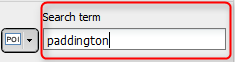
In the entry field Search term enter the term you are looking for.
While entering the details, a list of suggestions opens.
Tip: You can limit the search by using search filters (see Use search filters (POI search, Data Manager)
-
Insert the required address with a double-click.
The entry is inserted in the list of stop-off points.
Tip: Alternatively, you can incorporate selected POIs from the map into the stop-off point list using F8.
Quick search in the databases and ferries "+ - search"
If you have created your own databases in the Data Manager and have made it available for a quick search, you can specifically search for the contents of fields using "+" (see How do I search for customers in route planning?).
Please note that the relevant fields must be set up as search fields (see Enable browsing according to field contents) If you want to identify a field as a search field in an existing database, you can do this in the Data Manager under Administration > Edit > Field description (see Enable browsing according to field contents).
You also have the option of searching for Ferries as POIs. This, for example, is a quick way to find all ferry connections for the city of Dover.
To search for the content of a description field, enter a "+" in the Address field and the term which is to be searched for.

Inserting home address as stop-off point
If you have defined a home address in the settings it can be inserted in the list of stop-off points using  Favourites>
  Home address (see Stop-off points).
Note: In the options you can define whether your home address should always be entered as starting point for a new route plan.
Inserting favourites as stop-off point
Up to five favourites can be defined in the settings (see Stop-off points). These can be inserted into the list of stop-off points using the Entry > Favourites.
Tip: You can link the last entry you inserted into the list with the Favourites button. If you insert Favourite 3, for example, into the stop-off list and save your profile (see Saving a profile), the corresponding stop-off point will immediately be added to the list when you click on Favourites.
Tip: Adding objects from the map
Instead of entering stop-off points, objects can be included in the list of stop-off points directly from the map. More information on this can be found in the article Adding Stop-Off Points from the Map.